
Quick share

Anyone moving from traditional canvassing to digital canvassing always asks the same question, "how do I get started?"
Getting to view your voter file in a visual capacity is one of the best things about making the switch. With Ecanvasser, the map functionality is one of our most powerful features.

When using Ecanvasser, the importing of your voter file is one of the most critical parts of your journey to ensure you get the most out of what our product has to offer. For many campaigns, the more advanced aspects of the voter file import are not as relevant as being able to see your voters on a map!
Uploading Your Voter File
Once you have set up a Campaign with Ecanvasser and logged on, navigate your way to the Import page, which is located under the Plan tab on the left hand side of your screen.
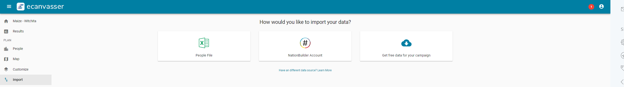
From here, you will have 3 options for pulling through your data to the Ecanvasser dashboard. Choosing between People File, Nationbuilder Account or Getting free Data from Nationbuilder.
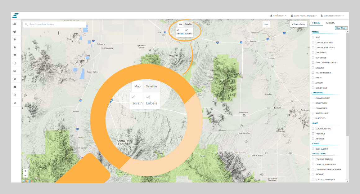
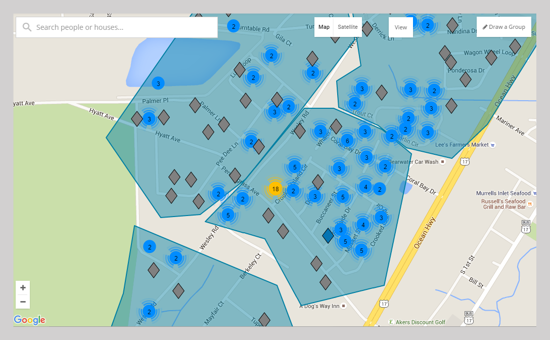
The Map view
You can see your map through a few different views on the Ecanvasser platform. We recommend you try out the differing options, and see which best suits your needs.
A) Select either Map or Satellite
B) Check/Un-check Terrain or Labels as desired

Houses
Each House in your People Database is located on your Map. Looking at the map, there will be a lot of different colours and icon, the following Key should help you identify what these symbols mean.

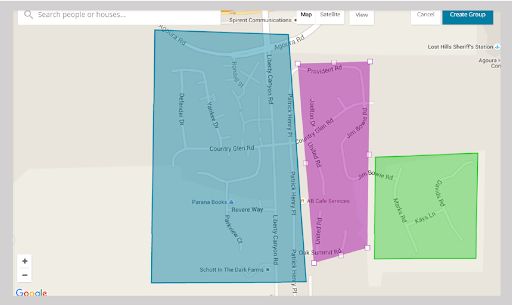
Groups
What's the point in having an map if you can't see your Groups easily? If you create groups in the Map tab, they will be seen like the following.
Blue: Indicates an ongoing canvass
Green: Represents a canvass that you have marked as complete
Purple: Currently selected
Clustering
Clustering is the term we use when you have a very densely populated database and therefore it can be hard to view all the houses on your map.
In instances such as this, the Clustering function provides a much more advantageous view, and will also assist in the speeding up load times.
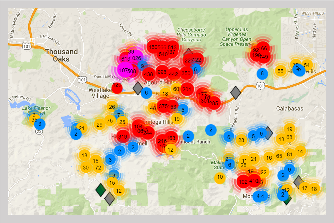
As you Zoom in, the Clustering function will continue to de-cluster houses, where individual Houses will be shown individually once more.
Why the Map View Rocks!
Visual campaigners find the graphic format of Ecanvasser indispensable. Looking at your voters on a map is a great way to pinpoint where your voters are based and what is the most time efficient way to knock on doors.
Using Ecanvasser is the best way to track doors knocked and votes gained.
Sign up for a free trial now to begin transforming your voter file!

.svg)


.svg)
.svg)